FSI and FAR in Tamil Nadu: A Developer Guide to Floor Space Index Rules
TNCDBR 2019 FSI rules for Tamil Nadu developers: road-width tiers, premium FSI charges, OSR, ground coverage caps, and CMDA vs DTCP differences explained with data tables.
On this page
- What FSI and FAR Mean — and Why They Drive Every Development Decision
- The TNCDBR 2019 Framework: Jurisdiction, Scope, and Definitions
- Non-High-Rise FSI Under Section 35: The 2.0 Baseline
- High-Rise FSI by Road Width: Section 39 in Detail
- Premium FSI: Buying Additional Built-Up Area
- How Premium FSI Charges Are Calculated
- Ground Coverage Caps and Minimum Floor Count
- Open Space Reservation (OSR): What It Takes Off the Top
- Metro Rail Corridor Advantage: The 50% Premium Charge Reduction
- Minimum Frontage and Road Width Requirements
- CMDA vs DTCP Areas: What Changes at the Planning-Authority Boundary
- Due Diligence: Verifying FSI Before You Bid
- Practical Worked Example: A 10,000 sqft Plot on a 15-Metre Road
Every development in Tamil Nadu begins with a number most teams get wrong: the maximum buildable area. Floor Space Index (FSI) — also called Floor Area Ratio (FAR) in older literature — tells you exactly how much built-up area the planning authority allows on a given plot. Get it right in feasibility and you protect your project economics; get it wrong and you may acquire land that cannot support your design brief at any reasonable cost.
This guide explains the TNCDBR 2019 rules that govern FSI across Tamil Nadu, from the road-width tiers that determine your permissible FSI to the premium mechanism that lets you buy additional area — and the OSR rules that quietly reduce the land you can build on at all.
What FSI and FAR Mean — and Why They Drive Every Development Decision
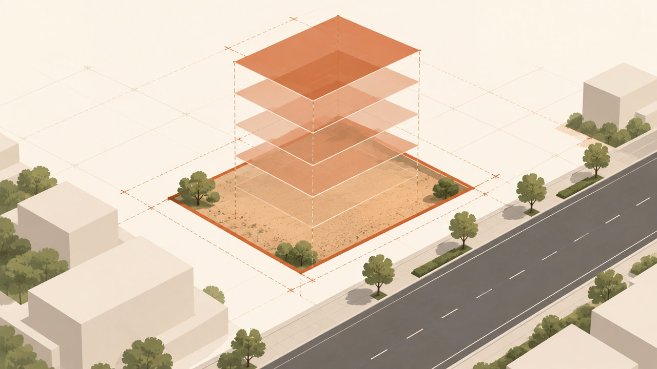
FSI (Floor Space Index) is the ratio of total built-up area to plot area. An FSI of 2.0 on a 1,000 sqm plot permits 2,000 sqm of built-up area across all floors. FAR (Floor Area Ratio) is the same concept expressed as the same ratio — the terms are interchangeable, though TNCDBR 2019 uses FSI throughout its operative sections.
The distinction that matters in practice is between permissible FSI and achievable FSI. Permissible FSI is the limit set by the regulation. Achievable FSI is constrained further by ground coverage, setbacks, minimum floor height, parking requirements, and — on larger layouts — OSR. A team that benchmarks FSI without accounting for these constraints will overestimate saleable area and underestimate the capital needed to absorb the gap.
| Concept | Definition | Governing rule |
|---|---|---|
| FSI / FAR | Total built-up area ÷ plot area | TNCDBR 2019 Sections 35 and 39 |
| Ground coverage | Footprint of the building ÷ plot area | Section 39 (high-rise), setbacks (non-HR) |
| Built-up area (BUA) | Sum of floor areas including walls | TNCDBR 2019 definition |
| Carpet area | Usable interior area; its ratio to BUA varies by design | Project-specific assumption |
| Permissible FSI | Maximum ratio before premium | Section 35 or 39 |
| Premium FSI | Additional ratio purchasable from planning authority | TNCDBR 2019 premium mechanism |
The TNCDBR 2019 Framework: Jurisdiction, Scope, and Definitions
The Tamil Nadu Combined Development and Building Rules 2019 (TNCDBR 2019) replaced the earlier separate CMDA and DTCP building rules with a unified framework. It applies to all planning authority areas in Tamil Nadu — Chennai Metropolitan Area (CMDA), municipal corporations, municipalities, town panchayats, and village panchayats governed by DTCP.
Two sections govern FSI for most developments:
- Section 35 — Non-high-rise buildings (height ≤18.30 metres). Sets a flat FSI regardless of road width.
- Section 39 — High-rise buildings (height >18.30 metres). Sets FSI by the width of the primary abutting road.
The high-rise threshold of 18.30 metres is the operative building-height dividing line for FSI, ground coverage, and minimum road-width requirements. Many teams still use the older 15-metre or 7-storey rule of thumb — the 18.30-metre threshold under TNCDBR 2019 is the operative standard.
| Building type | Height threshold | Applicable section | Primary FSI driver |
|---|---|---|---|
| Non-high-rise | ≤18.30 m | Section 35 | Plot designation; flat 2.0 |
| High-rise | >18.30 m | Section 39 | Abutting road width |
Non-High-Rise FSI Under Section 35: The 2.0 Baseline
For buildings within the 18.30-metre height limit, Section 35 sets a flat FSI of 2.0. This applies uniformly across the CBA (Central Business Area), EWS (Economically Weaker Section), and Other Area designations. Road width does not change the baseline FSI for non-high-rise — it only affects what premium FSI percentage you can purchase on top.
A 2.0 FSI on a 2,400 sqft (approximately 223 sqm) plot permits 4,800 sqft of FSI area. If a feasibility model assumes 78% efficiency, that would imply approximately 3,744 sqft of carpet area; the actual ratio must come from the proposed design and the applicable area definitions.
The practical implication for acquisition teams: non-high-rise feasibility is simpler to model but more constrained by setbacks and ground coverage. A developer targeting a 4-floor building on a narrow plot in a residential area will typically find that setback requirements limit the per-floor footprint well before FSI becomes the binding constraint.
| Plot area | FSI | Max FSI area | Illustrative carpet area (78% assumption) |
|---|---|---|---|
| 2,400 sqft (223 sqm) | 2.0 | 4,800 sqft | ~3,744 sqft |
| 5,000 sqft (465 sqm) | 2.0 | 10,000 sqft | ~7,800 sqft |
| 10,000 sqft (929 sqm) | 2.0 | 20,000 sqft | ~15,600 sqft |
| 43,560 sqft (1 acre) | 2.0 | 87,120 sqft | ~67,954 sqft |
High-Rise FSI by Road Width: Section 39 in Detail
For buildings exceeding 18.30 metres, the permissible FSI is set by the width of the abutting road under Section 39. A road below 12 metres disqualifies the plot from high-rise development entirely — no variance mechanism exists in the standard rules.
The road width thresholds and corresponding FSI values are:
| Abutting road width | Permissible FSI (high-rise) | Min road for this tier |
|---|---|---|
| Below 12 m | Not permissible | — |
| 12 m – below 15 m | 2.0 | 12 m |
| 15 m – below 18 m | 2.5 | 15 m |
| 18 m or wider | 3.25 | 18 m |
This road-width dependency can create a significant valuation gradient. The difference between FSI 2.5 and FSI 3.25 on a 10,000 sqft plot is 7,500 sqft of FSI area. Acquisition teams should confirm the qualifying road width and the prescribed length of that road with the planning authority. Rule 39 also provides for a road-width certificate where a qualifying-road subdivision is absent from the FMB sketch.
| Road width | FSI | Max BUA on 10,000 sqft plot | Difference vs 18m+ tier |
|---|---|---|---|
| 12–15 m | 2.0 | 20,000 sqft | −12,500 sqft |
| 15–18 m | 2.5 | 25,000 sqft | −7,500 sqft |
| 18 m+ | 3.25 | 32,500 sqft | — |
A site measurement alone does not settle the qualifying road width. Check the road-space definition and Rule 39’s prescribed road-length conditions with the competent authority before committing to a high-rise scheme.
Premium FSI: Buying Additional Built-Up Area
On top of the permissible FSI, Tamil Nadu allows developers to purchase additional built-up area from the planning authority through the premium FSI mechanism. The additional percentage varies by road width, independent of whether the building is high-rise or non-high-rise.
| Abutting road width | Additional FSI purchasable |
|---|---|
| 9 m – below 12 m | 30% of permissible FSI |
| 12 m – below 18 m | 40% of permissible FSI |
| 18 m or wider | 50% of permissible FSI |
On a 15-metre road with non-high-rise (Section 35, FSI 2.0), the additional premium FSI allowance is 40%, which translates to an extra 0.80 FSI — bringing total built-up area from 2.0 to 2.80 times the plot area. On a high-rise plot on an 18-metre road (FSI 3.25), the 50% additional allowance adds another 1.625 FSI, pushing the theoretical maximum to 4.875.
Premium FSI still requires planning approval. Treat it as a scenario in feasibility until the authority has confirmed that the parcel and design qualify.
How Premium FSI Charges Are Calculated
The premium FSI charge is calculated on the additional built-up area (not the total BUA) using the plot’s guideline value and a charge factor that depends on building type — not road width. This is a frequently mislabelled distinction.
| Building type | Premium charge factor |
|---|---|
| Non-high-rise (≤18.30 m) | 50% of guideline value (₹/sqft) × additional BUA (sqft) |
| High-rise (>18.30 m) | 40% of guideline value (₹/sqft) × additional BUA (sqft) |
Worked calculation — non-high-rise, 15-metre road:
| Input | Value |
|---|---|
| Plot area | 10,000 sqft |
| Road width | 15 m |
| Building height | ≤18.30 m (non-high-rise) |
| Permissible FSI (Section 35) | 2.0 |
| Additional FSI (40% of 2.0) | 0.80 |
| Additional BUA | 8,000 sqft |
| Guideline value | ₹3,500/sqft |
| Charge factor (non-high-rise) | 50% |
| Premium FSI charge | 8,000 × ₹3,500 × 0.50 = ₹1.40 crore |
The guideline value used for this calculation is the TNREGINET-published value for the specific street and village. Use the Tamil Nadu Guideline Value Lookup to pull the current official figure before modelling premium FSI costs. Guideline values are revised periodically — using a stale figure can materially mis-estimate this line item.
Ground Coverage Caps and Minimum Floor Count
Ground coverage — the ratio of building footprint to plot area — imposes a second constraint on FSI utilisation. Once you know the permissible (and premium) FSI, ground coverage determines how many floors are needed to absorb it.
| Building type | Maximum ground coverage | Basis |
|---|---|---|
| Non-high-rise | ~65% effective | Governed by setback requirements; no explicit percentage cap |
| High-rise | 50% hard cap | Section 39 explicit limit |
For high-rise on a 10,000 sqft plot:
- Maximum footprint: 5,000 sqft (50% cap)
- With FSI 3.25: total BUA = 32,500 sqft
- Minimum floors required: 32,500 ÷ 5,000 = at least 7 floors
This constraint is particularly relevant for mid-size plots in the 5,000–15,000 sqft range where a developer may want fewer floors but FSI pushes the requirement higher to fit the permissible BUA within the footprint cap. The FSI / FAR Calculator derives minimum floor count automatically from your plot area, road width, and building height inputs — use it to verify that your design stacks correctly against both FSI and ground coverage.
Open Space Reservation (OSR): What It Takes Off the Top
Open Space Reservation (OSR) is land reserved for community recreation under TNCDBR 2019. Rule 41 addresses specified building developments; Rule 47 addresses layouts and subdivisions. The reserved land affects the physical building envelope, but Rule 39 expressly permits FSI benefit for OSR land in the stated high-rise circumstances. Do not automatically subtract OSR land from the FSI calculation.
OSR tiers by plot size:
| Plot size | OSR requirement | Mechanism |
|---|---|---|
| ≤3,000 sqm | Nil | Exempt |
| >3,000–10,000 sqm | Land option: 10% of area excluding roads; fee option: equivalent land value excluding the first 3,000 sqm | Confirm the applicable Rule 41 or 47 route with the authority |
| >10,000 sqm | 10% of the area excluding roads | Mandatory land reservation; no payment in lieu |
For a simplified middle-tier payment-in-lieu estimate with no internal-road deduction, calculate 10% × (site area − 3,000 sqm), convert that area to the unit used for the official guideline value, then multiply by that value. For the land option, calculate 10% of the site area excluding roads. The competent authority must confirm the applicable area and valuation.
OSR impact on a 1-acre layout (approximately 4,047 sqm):
| Metric | Value |
|---|---|
| Total plot area | 4,047 sqm |
| OSR tier | 3,001–10,000 sqm (land or fee) |
| Portion excluded from fee calculation | 3,000 sqm |
| Area used for fee calculation | 1,047 sqm |
| Land option (10%, assuming no roads) | 404.7 sqm (~4,356 sqft) |
| Equivalent land for fee option (10%) | 104.7 sqm (~1,127 sqft) |
| Indicative payment in lieu @ ₹3,500/sqft | ~₹39.44 lakh (1,126.9 sqft × ₹3,500; use current GV) |
| Area remaining outside OSR | ~3,642 sqm if land is reserved; 4,047 sqm if payment in lieu is accepted |
For layouts, Rule 47 requires the reserved land and public roads to be transferred to the local body by registered gift deed before layout sanction. Budget the conveyance and approval steps into the schedule. Calculate both land and fee scenarios from the current rule text and obtain the authority’s parcel-specific determination.
OSR can also apply to building developments under Rule 41. Do not assume an undivided, single-building site is automatically exempt.
Metro Rail Corridor Advantage: The 50% Premium Charge Reduction
Rule 30(5)(ii) provides that properties within 500 metres of the centre line of an existing or proposed Metro Rail corridor are charged 50% of the normal premium FSI rate. It does not state the same concession for every MRTS or suburban rail corridor. The provision changes the charge, not the permissible FSI percentage.
| Scenario | Premium FSI charge | After Metro discount |
|---|---|---|
| 10,000 sqft, non-high-rise, 15m road, GV ₹3,500/sqft | ₹1.40 crore | ₹70 lakh |
| 20,000 sqft, high-rise, 18m+ road, GV ₹4,000/sqft | ₹5.20 crore | ₹2.60 crore |
Get written confirmation of corridor status before incorporating the discount into feasibility. The 500-metre distance is measured from the corridor centre line, not from the nearest station. The FSI / FAR Calculator includes a Metro corridor toggle; use it only after that eligibility check.
For Chennai acquisitions in corridors served by the existing and Phase 2 Metro network, the discount is a material feasibility lever — particularly on larger high-rise plots where premium FSI charges run into several crores. See our Chennai land acquisition guide for corridor-specific context.
Minimum Frontage and Road Width Requirements
Frontage — the plot’s street-facing edge — sets a minimum viability threshold independent of FSI. A plot may qualify for high FSI on paper but fail the frontage test for the intended building type.
| Building type | Frontage check | Minimum abutting road width |
|---|---|---|
| Non-high-rise | Test the design against the applicable setbacks and access rules | Rule 35 varies by building size and use |
| High-rise | Test the design against setbacks on all sides and access rules | 12 metres for the lowest high-rise FSI tier |
The rules do not give a universal 6-metre or 12-metre frontage minimum for these two categories. Frontage is a design feasibility check, not a substitute for the rule’s road-width, access and setback requirements.
The interaction between frontage and setbacks is worth modelling explicitly during site selection. Front, side, and rear setbacks remove a portion of the plot from the building footprint — on a narrow plot, cumulative setbacks can reduce effective ground coverage below the 50% cap, making the ground coverage cap non-binding but also limiting the per-floor footprint to far less than the FSI headroom would suggest.
CMDA vs DTCP Areas: What Changes at the Planning-Authority Boundary
Both CMDA and DTCP areas use TNCDBR 2019 as the starting point for FSI review. The competent authority, applicable master plan and any special area restrictions must be checked for the parcel.
| Dimension | CMDA (Chennai Metropolitan Area) | DTCP (outside CMDA) |
|---|---|---|
| Governing rules | TNCDBR 2019 | TNCDBR 2019 |
| Section 35 FSI (non-HR) | 2.0 | 2.0 |
| Section 39 FSI (high-rise) | Road-width tiers (same) | Road-width tiers (same) |
| OSR determination | Rule 41 or 47 and site history | Rule 41 or 47 and site history |
| Building-plan approval authority | Confirm with CMDA / local body | Confirm with DTCP / local body |
| Premium FSI decision | Confirm with competent authority | Confirm with competent authority |
| Official portal | cmdachennai.gov.in | tn.gov.in (DTCP) |
Historical subdivision and master-plan records can affect a parcel’s OSR treatment. Obtain the registered subdivision instruments and prior approvals before assuming a historical exemption applies.
For agricultural land being converted to non-agricultural use and then subdivided, assess OSR at the layout-sanction stage as well as the separate land-use permission. See our guide to agricultural land conversion in Tamil Nadu for the approval sequence.
Due Diligence: Verifying FSI Before You Bid
FSI verification for an acquisition should be completed before the letter of intent stage — once you have committed to a price based on a development scheme, discovering that the FSI assumption is wrong means either repricing the deal or absorbing an economic loss.
FSI due diligence checklist:
| Check | What to verify | Source |
|---|---|---|
| Official road width | Confirm road space and qualifying length under Rule 39 | Local planning office / CMDA |
| Building height intent | Confirm high-rise vs non-high-rise basis; check 18.30m threshold | Design brief |
| Metro corridor status | Written confirmation of 500m corridor proximity | CMDA / DTCP |
| Frontage measurement | Verify street-facing edge against FMB and survey | FMB/TSLR tool |
| OSR applicability | Check plot size and layout vs single-building determination | TNCDBR 2019 Rule 41/47 |
| Guideline value | Pull current ₹/sqft from TNREGINET for premium FSI cost modelling | Guideline Value Lookup |
| Land use classification | Confirm residential, commercial, or mixed-use designation | Applicable master plan / planning authority |
| Conversion status | Confirm required land-use conversion for agricultural-origin land | Land conversion records |
| Encumbrance | Check for mortgages, attachments, or pending litigation | EC verification |
| Planning approval status | Check if plot is in approved layout or unapproved | Local authority records |
Most of these checks are document-level verifications rather than site inspections — they can be completed in parallel once you have the survey number and patta details. The highest-risk item is road width: a 1-metre error in road classification can change the permissible high-rise FSI from 3.25 to 2.5, reducing maximum BUA by 20% on the same plot.
Practical Worked Example: A 10,000 sqft Plot on a 15-Metre Road
This example illustrates how the TNCDBR 2019 rules interact for a residential development scenario. The regulatory assumptions come from Rules 39 and 49; the carpet-area estimate is a separate, illustrative design assumption.
Inputs:
| Parameter | Value |
|---|---|
| Plot area | 10,000 sqft (929 sqm) |
| Abutting road width | 15 m |
| Building height | 20 m (high-rise) |
| Guideline value | ₹4,000/sqft |
| Metro corridor | No |
Derived outputs:
| Output | Value | Basis |
|---|---|---|
| Classification | High-rise (>18.30 m) | Section 39 |
| Permissible FSI | 2.5 | Section 39: 15m road |
| Max BUA (permissible) | 25,000 sqft | 10,000 × 2.5 |
| Ground coverage cap | 50% (5,000 sqft max footprint) | Section 39 |
| Min floors required | 5 floors | 25,000 ÷ 5,000 |
| Additional premium FSI | 40% of 2.5 = 1.0 | 12–18m road tier |
| Max BUA with premium | 35,000 sqft | 25,000 + 10,000 |
| Additional BUA (premium) | 10,000 sqft | |
| Premium charge factor | 40% (high-rise) | |
| Premium FSI charge | ₹1.60 crore | 10,000 × ₹4,000 × 0.40 |
| Illustrative carpet area (permissible FSI area × 78%) | 19,500 sqft | Design assumption, not a statutory ratio |
At permissible FSI alone, this plot yields approximately 19,500 sqft of carpet area across 5+ floors. Purchasing premium FSI adds another 7,800 sqft of carpet area (10,000 × 0.78) at a cost of ₹1.60 crore — roughly ₹2,050/sqft of additional carpet area, before construction costs. Whether that premium is worth paying depends on the achievable sale price per sqft for the location.
Use the FSI / FAR Calculator to run this calculation live with your actual plot area, road width, guideline value, and Metro corridor status.
Sources: the Tamil Nadu Combined Development and Building Rules 2019, especially Rules 30, 35, 39, 41, 47 and 49; TNREGINET for parcel-specific guideline values. Check subsequent amendments and obtain parcel-specific confirmation from the planning authority before finalising a development plan.
Sources and editorial notes
Sources
- Tamil Nadu Combined Development and Building Rules, 2019 — Commissionerate of Municipal Administration, Government of Tamil NaduPrimary source · Checked
Frequently Asked Questions
What is the FSI for non-high-rise buildings in Tamil Nadu?
How is FSI determined for high-rise buildings in Tamil Nadu?
What is premium FSI in Tamil Nadu and how much does it cost?
What is the OSR requirement for layouts in Tamil Nadu?
Does FSI apply the same way in CMDA and DTCP areas of Tamil Nadu?
Calculate FSI and premium built-up area for your plot
Enter road width, building height, and guideline value to derive permissible FSI, premium charges, and minimum floor count.
Open the FSI / FAR CalculatorContinue reading
Joint Development Agreement in India: Due Diligence Guide for Land Acquisition Teams
A practical due diligence guide for JDA land in India — title chain, EC scope, revenue records, FMB verification, planning approvals, and Tamil Nadu registration rules.
Patta Mutation in Tamil Nadu: A Complete Guide for Land Acquisition Teams
After a registered purchase, patta transfer updates the revenue record. This guide covers Tamil Nadu application routes, the published e-Sevai service charge, disposal instructions, and evidence tracking for acquisition teams.
How to Verify Land Ownership in India Before Buying
A practical guide to checking title deeds, revenue records, encumbrances, litigation, boundaries, and succession before buying land in India.